For no reason other than because it is there, I have
wanted to ride all 180 miles of the C&O Canal Towpath from Cumberland, MD
to Georgetown for many years. Riding
buddies and I would talk about it, but it never fell together. It is best to do it in late June, when there is
maximum daylight, and because it is a one-way ride, you need to find someone to
drive you the night before or do a one-way car rental. The combination of logistics and narrow
window of opportunity always seemed to keep the ride from happening. This year I thought would be more of the
same. My friend Lane and I discussed
doing it, and began planning, but he hurt his knee and could not do it. My friend Nick also was interested, but could
only do it on a weekend I could not.
Disappointed but resigned, I began to put it out of my mind as June
ticked away. One Friday at Friday
Coffee Club (a weekly gathering of bike commuters), I mentioned the idea to
Rudi. Surprisingly he said he would love
to. Rudi is a very strong rider -- an A
rider in our club's classification system -- who is always at the front of the
fast group he rides with. I am a strong
rider, but not particularly fast, so I was a bit concerned that we would not be
compatible on the trail. As it turned
out, that was not a problem at all, and Rudi was great company. I did not have to race to keep up and don't think he had to soft-pedal to keep from dropping me. After confirming schedules and
commitments at home, we both realized we could make it work on June 29. A few minutes on the computer was all it took
to book a hotel room and a rental car, and we were set.
The overall plan was simple. Start the ride as close to daybreak as
possible, keep breaks to a minimum, and try not to go too far from the trail to
find stores. The towpath itself is flat,
trending downhill as we would be heading downstream. So other than the times we left the towpath,
there would be no climbing at all on the route.
You can see the map of our route here.
On paper, it looks easy. Flat to
downhill, no traffic, mostly shaded, with water and portalets located every
5-10 miles. There were towns located
immediately off the trail every 20-25 miles if we needed food or ice. There are even a couple of bike shops along
the way in case we had a serious mechanical.
The towpath itself is packed dirt or crushed stone, which makes for a
good riding surface for bikes with wider tires.
With that in mind, I plotted out a schedule with rest stops that assumed
a 16 mph moving pace and rest stops every 20-25 miles. The stops were mostly shortish -- 15 or 20
minutes for a cold drink and snack -- with a couple of longer stops for second
breakfast and a late lunch. With this
schedule I assumed we would roll out at first light at about 5:15 and get to
Georgetown at about 8. With the long
days, it does not get dark until close to 9, so that schedule gave us almost an
hour of daylight to play with to account for contingencies.
In the days leading up the ride, Rudi and I got our
bikes in order. Rudi would ride his
Marin mountain bike fitted with a suspension fork and slick tires instead of
knobbies. I would ride my VO Campeur
touring bike, my regular commuting bike, with wide 35 mm tires.

We both planned to carry plenty of food and
repair gear so we could keep breaks short.
The plan was for me to pick up Rudi after work on Friday, head up to
Cumberland, and be in the room early to get a good night's sleep before our
early start. However, DC experienced
torrential rains right at rush hour so traffic leaving town was horrendous
putting us behind schedule from the start.
We decided to stop for dinner in Hagarstown, about half-way, but we both
agreed that the usual interstate fast food options were not acceptable so we
drove into downtown Hagarstown to see what we could find. After a bit of circling we found a nice
section of downtown undergoing a bit of a revivial. We parked and found a great looking place
called 28 South. They had a great beer
list and fish tacos on the menu so we were sold. Dinner was great, and we left feeling
comfortably full and happy with our find.
By the time we drove on the Cumberland, checked in, found a grocery to
get breakfast foods, and returned the car, we did not settle into the room
until almost midnight. Between pre-ride
jitters (did I remember gloves?) and the steady rumble of trains on the tracks
right behind our hotel we did not get much quality sleep.
Our cell phones chirped us awake right on cue at
4:30. We were not moving fast. Hotel room coffee helped some, but not
enough. We finally fumbled ourselves
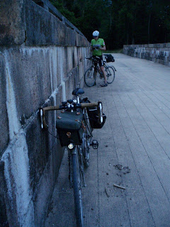
together and rolled a few blocks through foggy Cumberland to find the canal
start. By the time we finished with the
obligatory pictures, social media check-ins, and texts home we were on the
trail at about 6, about 45 minutes later than planned. It quickly became apparent that we would not
make that time up in the early going.
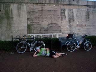 |
| Beefcake Rudi at Mile 0 |
The trail in the upper end of the towpath was pretty
muddy, and the rainstorms over the previous days left lots of puddles and muddy
spots that were tricky to negotiate. The
trail itself consisted of two tracks with a grassy "median" so there
was no way to avoid the puddles we had to concentrate on the path to stay
upright. It was not long before our legs
and bikes were caked in mud. But, the
riding was great. It was pleasantly cool
in the early morning and we saw lots of rabbits and few deer, and heard lots of
birds as we rode along. It is hard to
bird while biking, but I did catch a glimpse of bright blue birds that looked
like Indigo Buntings. It was fun
negotiating the trail and finding the best (or least worst) line through the
puddles and mud pits, but it took a lot of concentration so we could not look
around too much. Not that there was much
to see because the dense tree cover obscured any views, and we only got occasional
glimpses of the Potomac and farms.
 |
| Cruising Along the Canal (Rudi) |
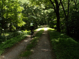 |
| The View for Much of the Day |
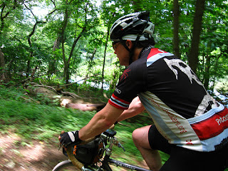
We rolled along chatting, splashing, and slipping in
the mud. We quickly adjusted our mindset
from our projected schedule to "it will be what it will be" and tried
to concentrate on having fun. After a
few short breaks trailside we reached our first big landmark, the Paw Paw
Tunnel. The tunnel is about 2/3 of a
mile long and pitch black. The path
through the tunnel is a narrow ledge about 10 feet above the water and the surface
is rough stone. Luckily there was a
fence and we had good lights, but it was a somewhat stressful and eerie ride
through the tunnel. Rudi's light
projected wild shadows of me onto the walls and roof of the tunnel. Of course a few loud whoops generated the
desired echoes and smiles.
 |
| Through the Paw Paw Tunnel (Rudi) |
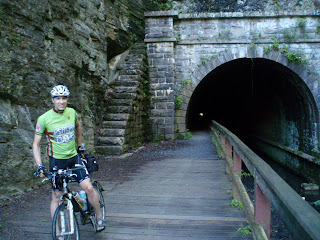 |
| Through the Paw Paw Tunnel |
After the tunnel we continued to roll along, and the
trail seemed drier and better drained, so we made better time. The day was also warming up as it reached
mid-morning and we approached our first store stop at Bill's Place in Little
Orleans. Bill's Place was great, if
strange. We walked in around 10 am into
a large space with a long L shaped bar to the left with two guys eating
breakfast at the bar, and one guy eating breakfast behind the bar. They may or may not have been drinking a beer
with breakfast. The store manager was
super friendly and helped us find our desired drinks and snacks, which we ate
on the porch while assessing the amount of mud on our bikes, and our
schedule. We running close to 2 hours
behind schedule at this point, so we decided to leave to the Towpath and ride
on the paved, parallel Western Maryland Rail Trail to pick up the pace and make
up some time.
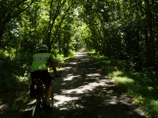 |
| Cruising on the Western Maryland Rail Trail |
Every long ride has a low point for me, sometimes
due to physical problems but usually it is an attitude problem because I am not
meeting an expected pace, hungry, or just not feeling great. My low on this ride came during this
stretch. Lots of little things bothered
me: my legs felt like they might cramp,
my shorts seemed to pinch my butt, I could not keep up with Rudi, we were never
going to get to Georgetown, what is that creaking sound from my bike? I am not sure what brought me out of my funk,
but the feeling of progress as we reached Hancock, and the opportunity for a
rest, cold drink and a snack at C&O Bikes, probably did it. Rudi wisely bought some oil for his suffering
chain and we had a quick snack while chatting with others and trying to get
cell signal to see who won Stage 1 of the Tour.
Soon, though, it was back on the Trail for a longish run to Williamsport
where we planned on eating a real meal (well, as real as a meal can be at a
Sheetz convenience market).
 |
| Selfie at the Paw Paw Tunnel |
Riding the towpath meant almost no turns to miss or
worry about. In fact, the only turns we
planned were obvious turns to get into towns like Little Orleans and
Williamsport that were all but impossible to miss. Nonetheless, we managed to miss the only
non-obvious turn on the route, as we missed the turn from the WMT back to the
Towpath where the link to the towpath looked like a private drive instead of a
public trail. So, we got a bonus mile to
ride and saw a big farm house where the owners had built a Field of Dreams
baseball field in their yard. Lucky
kids! The short mile on a normal road,
including a couple of little ups and downs, felt good after the miles and miles
of flat riding. Riding the flat trail
meant using the same muscles, and we felt more tired and stiff than the level
of exertion would suggest. We got into
the habit of standing while pedaling every so often to stretch out a bit and
use different muscles.
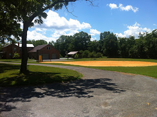 |
| Home Made Field of Dreams (Rudi) |
Back on the trail we made good time and were
thankful for the thick tree canopy that kept us sheltered from the sun and
wind. We took a few breaks for water
from the potable pumps along the trail, and to take pictures at Dam No. 5. We also caught glimpses of Summer on the
river, as there were several RV campgrounds, and sections of summer homes along
the river and canal. Folks were sitting
out enjoying afternoon snacks and beers, and some of these campsites looked
very elaborate. Shortly after leaving
Dam No. 5 Rudi felt his bike get very squirrelly and realized he had a
flat. A bit frustrating, but the tire
was not damaged and we got the tube replaced and were back on the trail pretty
quickly. We figured Rudi had had a slow
leak for miles, which probably explains how I could keep up with him. As it turned out, that was the only
mechanical problem we had the whole day.
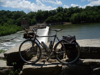 |
| The Campeur Astride Dam No. 5 |
By the time we got to Williamsport we were both
hungry and ready for lunch. Sheetz
delivered the goods with cold drinks and a decent turkey sandwich with salty/vinegary
chips. We enjoyed lunch in cycling
glamour, while sitting on a pallet that served as the anti-freeze display out
front. Sitting there, caked in mud and
sweat, we drew quite a few incredulous, and well deserved, stares. We were now well off our schedule and began
to plan for finishing up well after dark and thinking of contingency plans. But we also knew we had good lights and were
both comfortable riding at night so decided it would be what it would be and to
take it as it came. I really appreciated
Rudi's attitude about the ride and our mutual lack of stress made the trip the
blast that it was.
 |
| Rolling Along (Rudi) |
We left Williamsport as the day reached its hottest,
and were again thankful for the shade.
We continued to see a good number of other cyclists and it was fun
exchanging greetings as passed each other.
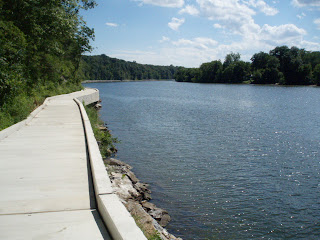
Not too long after Williamsport we reached a section of the towpath that
had been washed out in a storm several years ago (Irene maybe?). For several years this section had been
closed off while they replaced the towpath with a man-made concrete path built
over the water. Hats off to the NPS
because the design was well done and it was a hoot to ride right along the
water. This section is also a wide
slackwater section of the river behind Dam No. 4 and there were lots of boats
on the water, and many people swimming.
We were sorely tempted to take a dip too, but pressed on.
 |
| Modern Towpath Above Dam 4 |
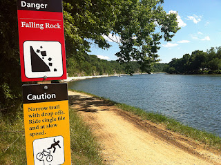 |
| Warnings (Rudi) |
We stopped for more pictures at Dam No 4 and then
rolled on to our next stop at Barron’s Store just off the trail a few miles
upstream from Shepherdstown WV, very near the Antietam Battlefield. The store was small but had the basic snacks
we needed. We also noted a pump and
chain tool available, one of the frequent signs that stores along the Towpath are
cyclist friendly. A cold Coke and candy
bar gave us the jolt we needed to press on into the late afternoon.
Passing Barron’s Store was a bit of a psychological
boost because from now on we would be riding very near areas where we
frequently ride, and we could recognize landmarks as we passed under roads and
near towns. We also were very much
looking forward to our next rest stop at Beans in the Belfry in Brunswick,
MD. Located in an old Church, Beans in
the Belfry features good coffee and food, friendly and helpful staff, and often
has live music. Originally scheduled as
our late lunch stop, it would now be our dinner stop as it was after 6:00. As we rolled up, we were thrilled to see that
they had installed a hose just for washing bikes, which was something our bikes
(and legs) very much needed.
Unfortunately they had not hooked up the water supply yet, so all four
of us remained unwashed.
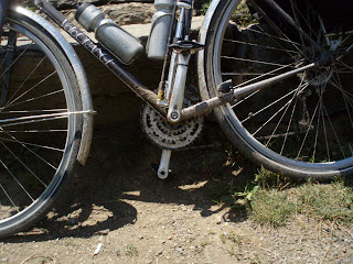 |
| Canal Bike |
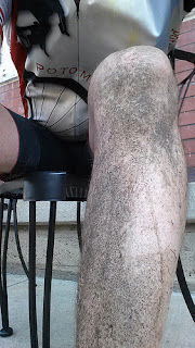 |
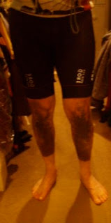
| Canal Legs |
Beans in the Belfry delivered. Yummy, salty quiche and a small salad, cold
drinks and a real bathroom made for a most welcome break. The place was filling up for the evening’s
music – Celtic folk – and I am sure we were quite the sight. We decided to eat at the outside tables to
keep the grossness quotient down. Rested
and fed, we headed out with the hope of making good time before it got dark.
 |
| Long Day on the Towpath |
As we left, we noticed gathering dark clouds to the
west and hoped we could avoid any rain.
Neither of us had brought rain gear as such, so we decided to hope for
the best. This part of the ride was
striking. The gathering clouds brought
an early dusk, and under the canopy it was quite dark. We rolled through alternating sections of
light and dark depending on the tree cover.
We saw quite a few deer on this stretch and Rudi saw a fox, and we
dodged countless frogs that leapt suicidally across the trail. The croaking (sound, not death) of frogs
would be our soundtrack for the next few hours, which was great accompaniment
to the steady rhythm of our wheels on the path.
We also saw lots of cyclists and hikers setting up camps next to the
trail as their day were ending. We
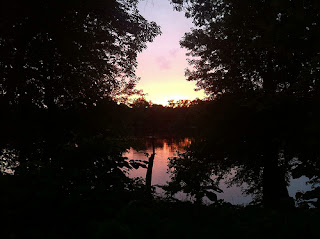
reached the Monocacy Aqueduct near Dickerson and paused to take pictures of the
sunset while a family fished off the bridge.
Shortly after that we glimpsed the Potomac turning deep golden red in
the sunset.
 |
| Bikes and Rudi on the Monocacy Aquedect |
 |
Sunset at Monocacy or
Prisoners of the Road |
 |
| Sunset on the Potomac (Rudi) |
Now it began to get dark as the sun set and we
entered a section of thick canopy. The
path was very overgrown with plants infringing on the path. More than once we were each wacked by nettles
as we brushed past, which stung for quite a while. Then we started to feel rain drops. We were maybe 5 miles from our next stop at
Whites Ferry and we quickly decided to push hard to get there and take shelter
if needed, and then assess whether we should continue or call for a ride. We pushed hard on this stretch and it took a
lot of concentration to barrel along the narrow track while avoiding mud, the
occasional branch and each other. The
rain picked up a bit, and then seemed to back off. We pulled into Whites Ferry just as it as
getting truly dark, and the last ferry rides of the day were ending as was the
rain. We got Cokes from the machine and
checked the weather radar on our phones. It looked clear to the west and there were no
warnings, so we decided to push on. The
Ferry crew just stared at us and frankly could not believe that we were going
to ride the remaining 35 miles in the dark.
I am sure they thought we were crazy, and to be honest they were
probably right.
The next stretch was the eeriest part of the
ride. It was now night and pitch black. The tree canopy was thick and all we could
see was the patch of light in front of our bikes. We had to concentrate on the path and really
had no idea where we were. We were also
tired and it was hard to do basic math, like estimating how far to the next
landmark at Riley’s Lock, and then to Great Falls. Riley’s Lock was farther than we expected and
I think we both had to fight a bit of nerves as we kept riding in our self-made
tunnel of light with no apparent end in sight.
Somewhere on
this stretch a caterpillar and an inchworm landed on my shorts. I lost the inchworm at Great Falls, but the
caterpillar stayed attached until I got home.
I hope he enjoyed the ride and his new home.
 |
| Rider on the Rider |
This stretch I began to think that my existence had been reduced to
pedaling; that was just what I did in life.
My legs actually felt fine and not particularly fatigued, so I felt that
I could just keep pedaling, although I very much wanted to be home with a cold
beer in my hand. Finally, we reached
Riley’s Lock, which was exactly where it should have been, and we felt
reconnected to the world.
As we rolled away from Riley's Lock we decided that it was too dark, and we were
too tired, to ride the steepish and rutted descents on the towpath at Great
Falls and Carderock. We decided to leave
the towpath at Great Falls and follow the paved path on MacArthur Blvd. into
Georgetown, where we could pick up the Towpath for the last mile or so to
Milepost 0. That plan worked well, and
the climb up from Great Falls to MacArthur actually felt great after all the
flat miles. The few aches I had in my
shoulder melted away. The descent down
past Old Angler’s Inn also felt great, and we rolled along the familiar route through Glen Echo and into DC. We cut down to
the Towpath near 34th St in Georgetown.
It was now just past midnight and we
experienced a bit of culture clash as we crossed streets teeming with dolled
up, and likely drunk, folks out on the town while we tried to keep upright
covered in mud and sweat. We finally
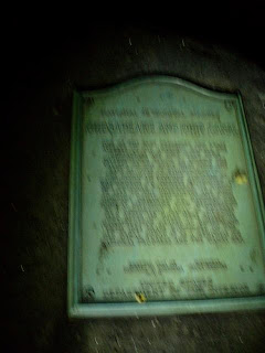
reached Milepost 0 a few minutes after midnight. The end was physically anti-climactic, with
just a simple sign and an historic marker in the pitch black darkness as the
towpath ended and the Rock Creek path began.
We shook hands, took a few pictures, and now focused on the fact that
the ride was not over because we had to get home!
 |
| The Bleary End |
Rudi lives just off Dupont Circle, so we rode the couple
of miles to his house, shook hands again and then I set off for my bonus 8
miles home. By this point I was simply
tired and made no effort to go fast; I just pedaled. The contrast between my filthy tired self and
the crowds of young, hormone and alcohol-infused crowds as I rolled through
Dupont, 18th St and U St made me smile, and probably made them want
to recoil in horror. I finally made it
home safe and sound at about 1:00 a.m. with 199.6 miles on the odometer. You could not have paid me to ride another .4
miles to make it an even 200.
It
took me a while to cool down and calm down, but the beer and shower felt great,
as did my bed. Best of all, I was not
overly sore even after almost 19 hours on the road! There was a bit of soreness in the shoulders
and a slight “hot foot” above the cleat, but nothing bad. I took a couple of prophylactic Motrin and
all but passed out.
 |
| Final Canal Legs |
The next day I was surprised to find no stiffness or
soreness in my legs, back or shoulder, and my butt felt fine. Other than the fact that it took much longer
than I had planned or expected, the ride was everything I had hoped for. My bike handled the terrain with aplomb, and
despite some close calls on the mud and gravel it stayed upright all day, and
we had all the food, supplies, and food we needed. The only “mistakes” we made were in the time
estimating, by being overly optimistic on the pace we could maintain and not
allowing for enough time to stop for photos and sightseeing. In the end, however, the surprising duration of the
ride added to the adventure and challenge, and the night riding was a lot of
fun, so those were the kinds of mistakes that enhance the quality of everything
else rather than ruin it all. As Rudi
said numerous times during the ride “It’s all good.” Most of all, the ride was fun, Rudi was great
company and it was well worth the effort.
I am not sure if I would do it again, but I would certainly recommend it
to others.
You can see all of my photos of the trip here, and all of Rudi's photos here. Rudi also did a nice, and much more concise blog post about the ride here. And for those of you you want to do a really deep dive, my GPS track of the ride, at least until the battery died jut before the end, is here, and Rudi's GPS track is here


